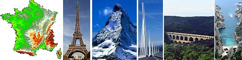
The France Page - Regions
Ile de France
Introduction
Île-de-France (literally Island of France) is the wealthiest and most populated of the twenty-seven administrative regions of France. It consists mostly of the Paris metropolitan area.
With 11.7 million inhabitants, Île-de-France is the most populated region of France.
Economically, Île-de-France is the world's fourth-largest and Europe's wealthiest and largest region. It is the wealthiest metropolitan area in the European Union.
Created as the District of the Paris Region in 1961, it was renamed after the historic province of Île-de-France in 1976, when its administrative status was aligned with the other French administrative regions created in 1972. Its name literally means "Island of France", possibly from ancient Frankish Liddle Franke, "little France". Despite the name change, Île-de-France is still popularly referred to by French people as the région parisienne (the "Paris region"). However, its inhabitants are more and more referred to as "franciliens", an adjective created in the 1980s. Ninety percent of its territory is covered by the Paris aire urbaine ("metropolitan area") which extends beyond its borders in places.
History
The province, also known as Isle de France (as it was once written, as sometimes in English, especially in old publications) is a historical province of France, and the one at the centre of power during most of French history. The historical province is centred on Paris, the seat of the Crown of France, but it does correspond to the present-day région Île-de-France: some parts of the historical province now are incorporated in the present-day region of Picardy, whereas other parts of the present-day région Île-de-France are taken from the historical province of Champagne.
The name Isle de France first appeared in 1387 when the term "France" began to designate territories of the Crown, replacing the pays de France.
The area around Paris was the original personal domain of the king of France, as opposed to areas ruled by feudal lords of whom he was the suzerain. This is reflected by divisions such as the Véxin Français and the Véxin Normand, the former being within the King of France's domain, the latter being within the Duke of Normandy's fief.
The Île-de-Province was divided into several subprovinces (French: pays). They were not administrative areas, but historic and cultural areas going back to the Western Roman Empire and readily identified by their inhabitants :
Beauvaisis – Beauvais
Brie française – Brie-Comte-Robert
Gâtinais français – Nemours
Hurepoix – Arpajon, Limours
Laonnois – Laon
Mantois – Mantes-la-Jolie
Noyonnais, Quart de Noyon – Noyon
Parisis (also known as Pays de France) – Paris
Soissonnois – Soissons
Vexin français – Magny-en-Vexin
Valois – Crépy-en-Valois
Modern history
4 February 1959: The District of the Paris Region (district de la région de Paris) was created by a government decree. This proved to be a failure, due to a lack of cooperation from the communes and the departments of the region; they refused to send their representatives to the district council.
2 August 1961: The District of the Paris Region was re-created with the same name, but this time by a statute (bill) voted by the French Parliament. The borders of this new region were coterminous with those of the current Île-de-France region. The district council of the aborted 1959 District of the Paris Region was replaced by a Board of Trustees, half of whose members were appointed by the French government, and the other half by the local communes and departments. The executive of the district was a civil servant, the Delegate General for the District of the Paris Region, appointed by the French government.
10 August 1966: Creation of the Prefecture of the Paris Region, whose borders were coterminous with those of the District (and to that of the current Île-de-France region). The Delegate General for the District of the Paris Region was made Prefect of the Paris Region, holding both offices at the same time.
17 December 1966: The district was renamed from "district de la région de Paris" to "district de la région parisienne". The English translation remains the same.
6 May 1976: The District of the Paris Region was transformed into the Île-de-France region, thus aligning the status of the region with that of the other French regions, created in 1972. The Prefecture of the Paris Region was renamed Prefecture of Île-de-France (Préfecture de L'Île-de-France). The former Board of Trustees was replaced by a regional council, 70% of whose members were the representatives of the departments and communes of Île-de-France. The remaining 30% were chosen by the Members of the French Parliament whose constituencies lay inside Île-de-France. The regional council elected a president with limited executive powers. The office of Delegate General was abolished. It was said that President Valéry Giscard d'Estaing personally insisted on choosing the name "Île-de-France" for the region, instead of the previously-used Région Parisienne. Île-de-France was the name of the historical province that existed before the French Revolution, but the name had long since fallen out of use. Today, many people and even some official institutions still continue to use the term Région Parisienne instead of the official name.
2 March 1982: Île-de-France, like the other French regions, was turned into a "territorial collectivity". In other words, it was transformed from a mere administrative region of the state to a full-fledged political entity, on a par with the departments and communes. The powers of the regions were expanded, direct elections of the regional councils were scheduled, and the presidents of the regional councils were given full executive powers.
16 March 1986: The first direct election of the regional council by the inhabitants of Île-de-France was held. The powers and visibility of the region were henceforth greatly increased.
Geography
Île-de-France has a land area of 12,011 km² (4,637 sq. miles). The built-up area of Paris fills its 12,011 km² to near 23%, and the Paris aire urbaine ("metropolitan area"), a built-up area and commuter belt) extends beyond its borders in places.
The region is composed of eight departments centered around its innermost department and capital, Paris. Around the department of Paris, urbanization fills a first concentric ring of three departments commonly known as the petite couronne ("small ring"), and extends into a second outer ring of four departments known as the grande couronne ("large ring"). The former department of Seine, abolished in 1968, included the city proper and parts of the petite couronne.
The petite couronne consists of the departments of Hauts-de-Seine, Seine-Saint-Denis, and Val-de-Marne, and the grande couronne of those of Seine-et-Marne, Yvelines, Essonne, and Val-d'Oise.
The river Seine also runs through the region. The Seine has many tributaries which include the rivers Oise and Aube. The river Seine has its mouth in the English channel and has its source in the 'Massif central'. It is France's second largest river after the Loire. The region is in an area of lowland called the Paris basin. South of the region lies the Massif-central.
Climate
The climate of the region is quite similar to those of England and western Germany, except that it has warmer summers and cooler winters than England, with less rain than England.
Demographics
Most of Île-de-France is covered by the Paris aire urbaine ("metropolitan area"), a statistical area encompassing the Paris pôle urbain ("urban area") and its couronne périurbaine (commuter belt).
At the 1999 census, 88% of the region's population lived in the Paris urban area and 99% lived in the Paris aire urbaine (9,644,507 and 10,842,037 people, respectively).
Immigration
Paris and the Île-de-France region is a magnet for immigrants, hosting one of the largest concentrations of immigrants in Europe. As of 2006, about 35% of people (4 millions) living in the region were either immigrant (17%) or born to at least one immigrant parent (18%).
If the region, primary seat of French political and economic power for centuries, has always attracted immigrants, modern immigration can be traced back to the second half of the 19th century when France emerged as an immigration destination with Eastern European Jews fleeing persecutions, and Southern Europeans (mostly Italians) and Belgians seeking better economic conditions. During the first half of the 20th century, immigrants were mostly Europeans, but after decolonisation, and during the French post-war economic boom, many immigrants came from former French colonies (chiefly the Magreb and West Africa). At the French census of March 1999, 2,159,070 residents of the Île-de-France region were people born outside Metropolitan France, making up 19.7% of the region's total population.
Economy
The GDP of the Île-de-France is the largest of NUTS-1 Regions in the European Union and is third per Capita after Luxembourg and Brussels. Paris with 2,2 million inhabitants with a GDP per Capita of 75,000 euros.
Source: Wiki under GNU
 |
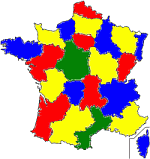
Return to French region map |
|